
The Historical Legacy of Srikakulam

Kalinga Kingdom
Srikakulam holds a prominent place in the history of the ancient Kalinga Kingdom, one of the oldest and most influential kingdoms in eastern India. During ancient times, the Kalinga region extended across present-day northern Andhra Pradesh, including Srikakulam, and parts of Odisha. Owing to its strategic coastal location, the region flourished as a center of trade, culture, and religion.
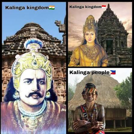
The Kalinga Kingdom gained historical significance after the Kalinga War (261 BCE) fought between Emperor Ashoka and the Kalinga rulers. Although Ashoka emerged victorious, the immense loss of life led him to embrace Buddhism and promote peace throughout his empire. This transformation greatly influenced the spread of Buddhism across the Kalinga region.
Srikakulam became an important center for both Buddhism and Hinduism. The ancient Buddhist site of Salihundam, located on the banks of the Vamsadhara River, is one of the region’s most significant archaeological treasures, featuring stupas, monasteries, and sculptures dating from the 2nd century BCE to the 12th century CE.
Following the decline of the early Kalinga rulers, the region came under the rule of several powerful dynasties, including the Eastern Gangas, Eastern Chalukyas, and Gajapatis, who contributed to the development of temples, art, architecture, and regional administration. Their rule helped preserve the rich cultural and religious heritage that continues to define Srikakulam today.
Buddhist heritage
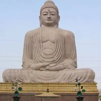
Srikakulam occupies a significant place in the Buddhist heritage of Andhra Pradesh, with its roots tracing back to the 3rd century BCE. Following the Kalinga War, Emperor Ashoka’s embrace of Buddhism encouraged the spread of Buddhist teachings across the Kalinga region, including present-day Srikakulam. The district became an important center for Buddhist learning, meditation, and monastic life, attracting monks, scholars, and pilgrims from different parts of India and abroad.
One of the district’s most renowned Buddhist heritage sites is Salihundam, situated on the banks of the Vamsadhara River, about 18 km from Srikakulam town. Excavations at Salihundam have revealed ancient stupas, chaityas, monasteries (viharas), sculptures, inscriptions, and relics, dating from the 2nd century BCE to the 12th century CE. The site reflects the influence of Hinayana, Mahayana, and Vajrayana traditions, making it one of the few places in India where all three schools of Buddhism flourished.
District Overview
Srikakulam District is the extreme Northeastern District of Andhra Pradesh situated within the Geographic Co-Ordinates of 18?-20’ and 19?- 10’ of Northern latitude and 83?-50’ and 84?-50’ of Eastern longitude. The Nagavali, Vamsadhara, Suvarnamukhi, Vegavathi, Mahendratanaya, Gomukhi, Champavathi, Bahuda and Kumbikota Gedda are the important rivers of the District . The Vamsadhara river rises in the Eastern Ghats of Orissa State and enters Srikakulam District in Bhamini Mandal and finally falls into the Bay of Bengal near Kalingapatnam. The Nagavali and Suvarnamukhi rivers also originate in the Eastern Ghats while Nagavali in Vangara Mandal and the confluence joins the Bay of Bengal at Kallepalli near Srikakulam Rising in Pachipenta hills the Vegavathi river flows from west to east, ultimately joining the river Suvarnamukhi, Gomukhi joins Suvarnamukhi at Sirlam Village of Vizianagaram District and Mahendratanaya which is Atributory of Vamsadhara joins the later at Komanapalli Village in Hiramandalam Mandal. Another river of the same Eastern Ghats flows through Mandasa and Sompeta Mandals and falls into Bay of Bengal at Baruva. The Bahuda river also rises in the Eastern Ghats enters into Srikakulam District at Boddapadu Village of Ichapuram Mandal and flows through Ichapuram, Kaviti and Mandasa and enters into Bay of Bengal at Donkuru. The District has a seacoast of 193 Kms.
CLIMATE

Srikakulam District has a tropical climate with three main seasons: summer, monsoon, and winter. Summers (March–June) are hot and humid, monsoons (June–September) bring moderate to heavy rainfall, and winters (November–February) are pleasant and cool. The district’s location along the Bay of Bengal influences its weather, making it suitable for agriculture, fisheries, and tourism throughout the year.
SOILS

Srikakulam District is endowed with a variety of fertile soils, including red soils, black soils, sandy soils, and alluvial soils. These soils are well-suited for agriculture and support the cultivation of major crops such as paddy, millets, pulses, groundnut, sugarcane, and cashew. The fertile river plains and coastal soils contribute significantly to the district’s agricultural productivity and rural economy.
AGRICULTURE
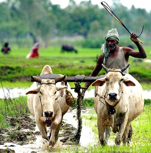
Agriculture is the primary occupation in Srikakulam District, supporting the livelihoods of a large portion of the population. The district’s fertile soils, favorable climate, and rivers like Nagavali and Vamsadhara make it ideal for farming. Major crops include paddy, millets, pulses, groundnut, sugarcane, cashew, and coconut, contributing significantly to the district’s economy.
LITERACY

Srikakulam District has made steady progress in the field of education, with continuous efforts to improve literacy through government schools, colleges, and educational programs. The district is home to numerous educational institutions that promote learning and skill development. Increasing literacy has contributed to social development, employment opportunities, and the overall growth of the district.
Leading Towns of Srikakulam
Srikakulam
Srikakulam Town is the district headquarters and the main administrative and commercial center of the district.
Amadalavalasa
Amadalavalasa is an important municipality in Srikakulam District, known for its railway connectivity and agricultural trade.
Palasa
Palasa-Kasibugga is an important municipality in Srikakulam District, known for its cashew industry and railway connectivity
Ichchapuram
Ichchapuram is an important border town in Srikakulam District, known for its trade activities and transport connectivity with Odisha.
Demographic Profile and Population Overview
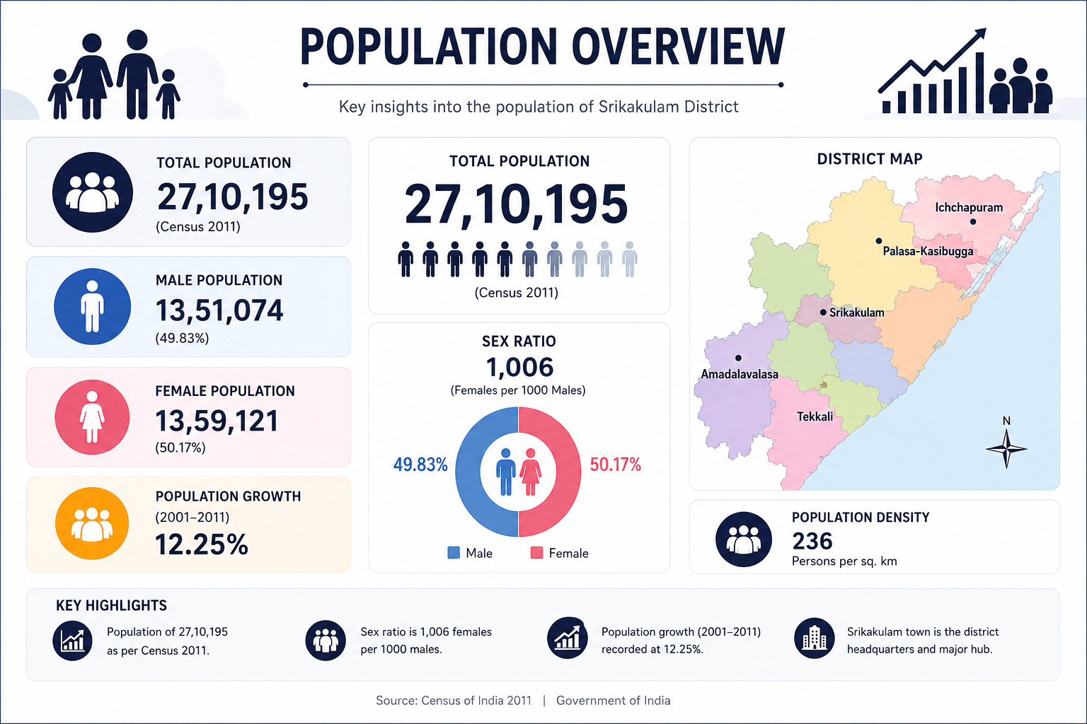
Srikakulam District is home to a diverse and vibrant population, reflecting a rich blend of cultures, traditions, and communities. The district comprises both urban and rural areas, with the majority of the population residing in villages and depending on agriculture, fisheries, and allied activities for their livelihoods. The district has witnessed steady growth in education, healthcare, and infrastructure, contributing to improved living standards and overall social development.
According to the 2011 Census, Srikakulam District had a population of approximately 27.10 lakh, with a balanced distribution of male and female residents. The district is known for its cultural diversity, strong community values, and peaceful coexistence among different social groups. Increasing literacy, expanding employment opportunities, and ongoing government development initiatives continue to enhance the quality of life and support the district’s sustainable growth.
Geographical Area
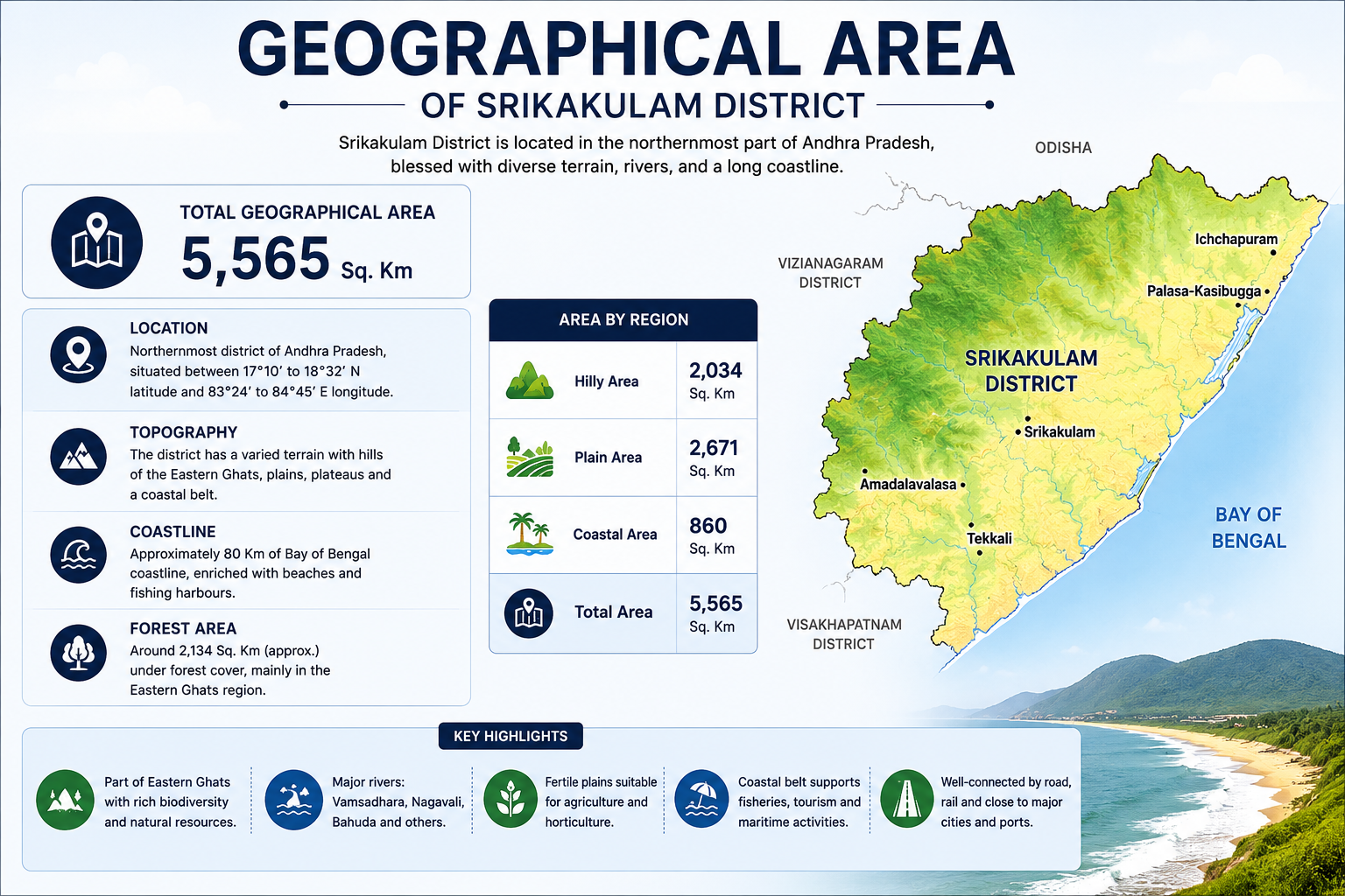
Srikakulam District covers a geographical area of approximately 5,837 square kilometers in the northeastern part of Andhra Pradesh. It is bordered by Odisha to the north, Vizianagaram District to the south and southwest, and the Bay of Bengal to the east. The district features a diverse landscape of fertile plains, the Eastern Ghats, river valleys, forests, and a picturesque coastline.
Major rivers such as the Vamsadhara, Nagavali, and Bahuda flow through the district, supporting agriculture, irrigation, and fisheries. The coastal belt, natural resources, and varied terrain contribute to the district’s rich biodiversity and economic development. With its unique blend of hills, rivers, forests, and coastal landscapes, Srikakulam is an important agricultural, ecological, and tourism destination in Andhra Pradesh.
District Profile & Key Statistics
| Statistic | Details |
|---|---|
| District Name | Srikakulam |
| State | Andhra Pradesh |
| District Headquarters | Srikakulam |
| Geographical Area | 5,837 sq. km |
| Population (2011 Census) | 26,99,471 |
| Male Population | 13,40,430 |
| Female Population | 13,59,041 |
| Sex Ratio | 1,014 females per 1,000 males |
| Literacy Rate | 61.74% |
| Official Language | Telugu |
| Major Rivers | Vamsadhara, Nagavali, Bahuda |
| Major Crops | Paddy, Cashew, Coconut, Sugarcane, Groundnut, Pulses |
| Climate | Tropical |
| Average Annual Rainfall | Approximately 1,160 mm |
| Number of Revenue Divisions | 2 |
| Number of Mandals | 30 |
| Major Towns | Srikakulam, Amadalavalasa, Palasa-Kasibugga, Ichchapuram |
| Coastline | Along the Bay of Bengal |
| Neighbouring State | Odisha |
| Major Industries | Cashew Processing, Agriculture, Fisheries, Rice Mills |
| Major Tourist Attractions | Arasavalli Sun Temple, Salihundam, Srimukhalingam Temple, Kalingapatnam Beach, Baruva Beach |
Revenue Overview
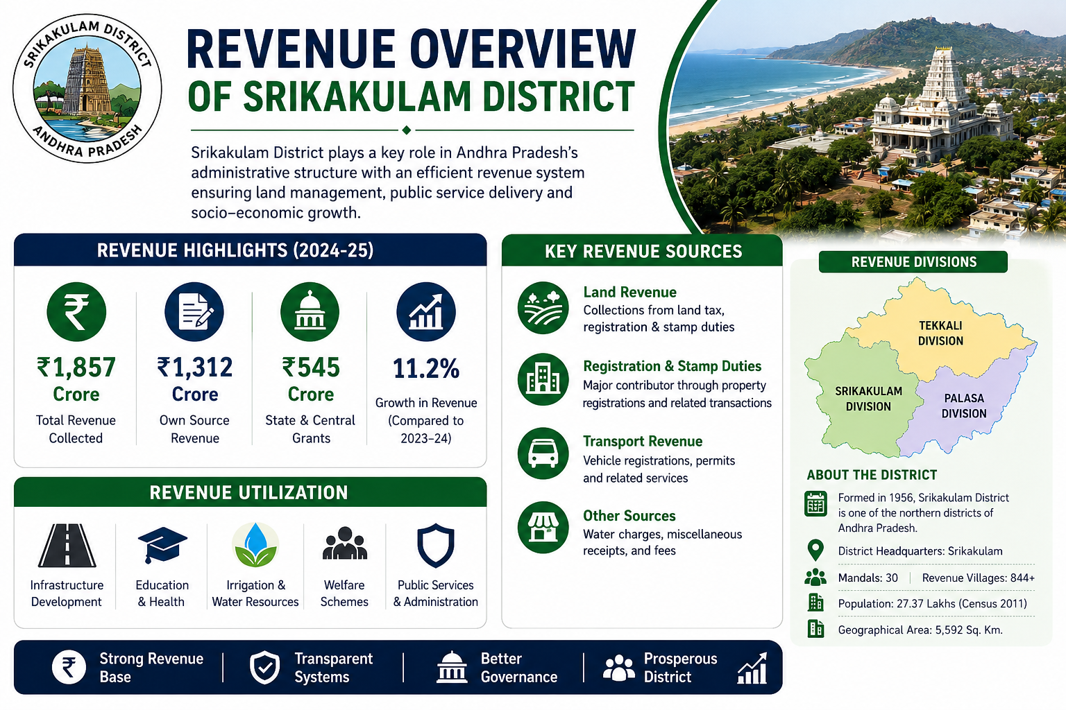
The Revenue Overview of Srikakulam District showcases the district’s strong administrative and financial framework that drives effective governance, economic stability, and sustainable development. The Revenue Department plays a crucial role in land administration, maintenance of land records, revenue collection, registration services, disaster management, and the implementation of various government welfare programs. These functions ensure transparency, efficient public service delivery, and better resource management across the district.
Revenue generated from land taxes, registration and stamp duties, transport-related services, and other government sources is strategically utilized for infrastructure development, education, healthcare, irrigation projects, rural development, public administration, and social welfare initiatives.